Project Moving Mountains
Throughout my 4 years at Bellarmine College Preparatory, I have traveled around the world and seen many different mountains with my own eyes, leaving me fascinated by their structure and formation. I have always had a gravitation towards the mountains; they give me a sense of scale for myself on Earth. They put in a moment of awe when I sit in the dirt and become mesmerized by their structure. I have become interested in the ancient influences in the mountain ranges and how they formed. I have photographed landscapes in the Scottish Highlands, the Atlas Mountains, the Nepalese Himalayas, and Japan's Mount Yake-Dake. From my deep curiosity about the origins of these mountains, under each different range, I learned the full origin of the mountains and how they formed.


The Scottish Highlands
The Iapetus Ocean, an ancient ocean where the modern-day Atlantic Ocean is, was closed off from the continent of Laurentia (modern-day North America and Greenland), colliding with microcontinents Baltica (modern-day Scandinavia and Eastern Europe) and Avalonia (modern-day England, Wales, and New England), creating the Caledonian Mountains or modern-day Scottish Highlands. This occurred about 450 million years ago. Looking at the rock banding of the first landscape, viewers can see rock that was once flat under the Iapetus Ocean that was pushed up to create the mountain in the image. The photo was taken looking in the west direction, which is the same direction the continent of Laurentia came from, moving east. The Caledonian mountains used to be peaks similar in resemblance to the Himalayas, but after almost 400 million years of erosion, the weathering has eroded the tips of the mountains down to stumps, giving the top of the mountain its plateau-like look.


The Atlas Mountians
Then 100 million years later (~300 million years ago), the continent of Gondwana collided with the continent of Laruassa, closing the Rheic Ocean and creating the Atlas Mountains. When looking at the last photo of the photos from the Atlas Mountains, viewers can see the layers in the mountains that are curved; those used to be flat at the bottom of the Rheic Ocean. When the continents collided, it pushed this rock up from the bottom of the ocean to create the very mountains I stood on to take these photos.

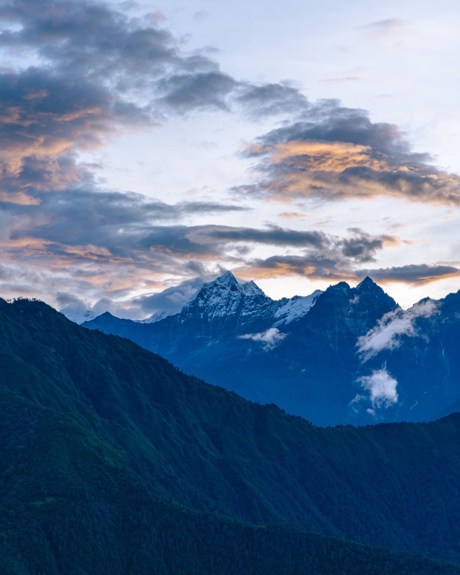
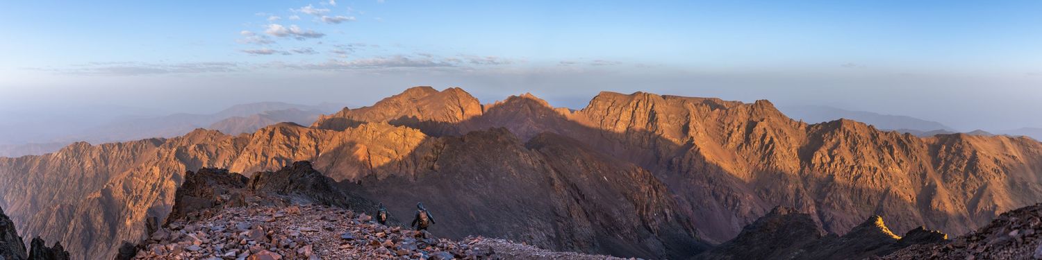
The Himalayas (Nepal)
In the next 100 million years (~200 million years ago), Pangea would break up with the supercontinent of Gondwana breaking up and the newly created Indian continent breaking off. India was originally next to Australia, but the ancient Tethyan ocean subducted (when the ocean floor goes underneath a continent), the Indian continent pulling it northward very fast; about 65 million years ago, the continent was moving at 20cm/year. The ocean pulled India toward Asia until it collided with it, creating the Himalayas. This collision is still happening today with Mount Everest growing at about 0.5cm taller every year and moving about 4cm northeast every year. In the images, the sharp peaks show evidence that the mountains are still growing since erosion hasn’t taken over yet. The peaks can be seen with the strongest and newest metamorphosed rock, and in the foreground, the older sedimentary and low-grade metamorphosed rock can be seen in the forested areas.

Mount Yake-Dake (Japan)
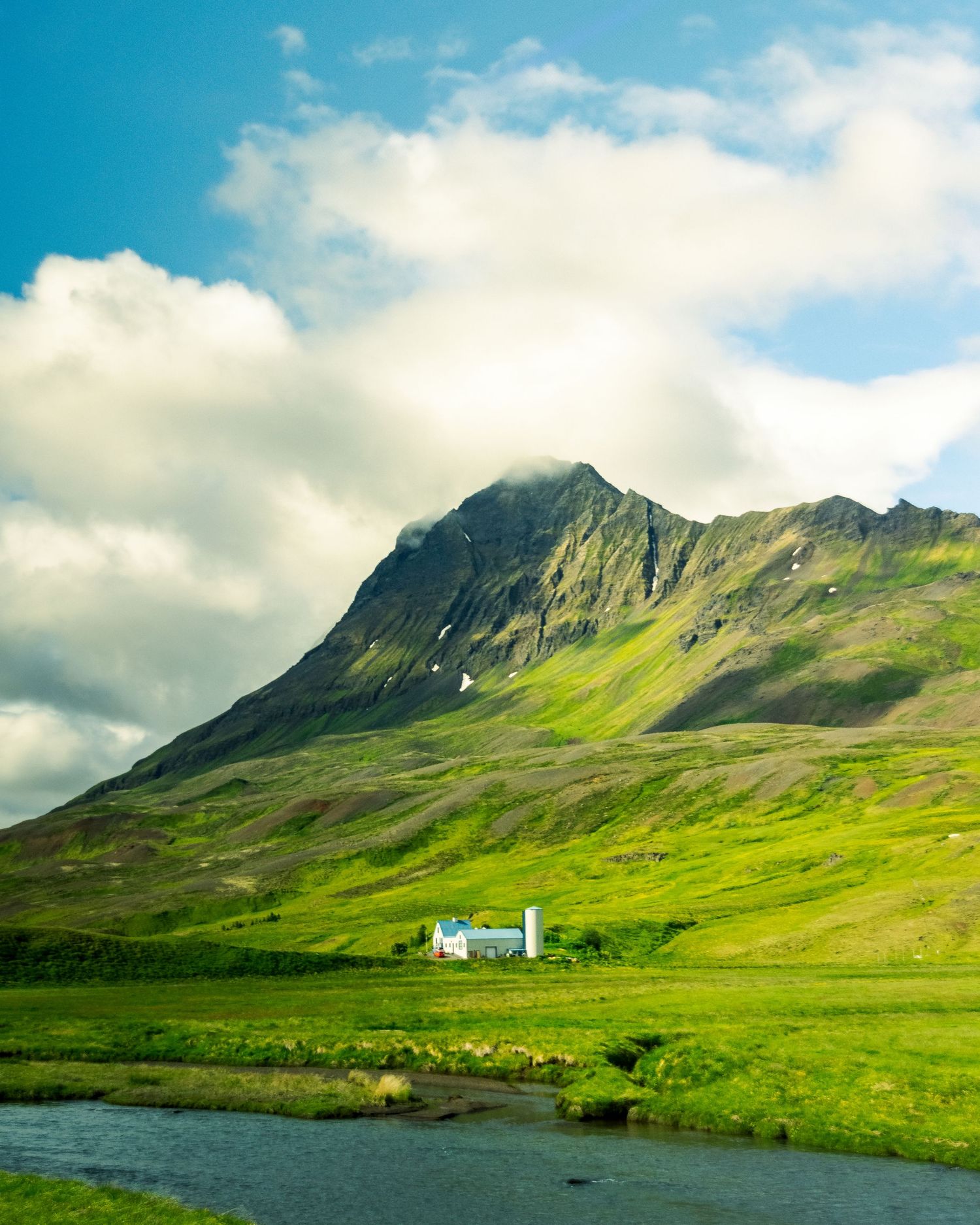
As Pangea broke up around 80 million years ago, and Asia drifted into place, the Pacific Ocean expanded due to subduction, allowing for cracks in the flooring, creating pathways for magma to surface to make granite to start the creation of proto-Japan (starting the Japanese Alps). At the crust, the magma reaches the surface, adding to the land form of the continent of Euroasia. Later, about 65 million years later, the Armorian plate starts to compress instead of stretching like it was before, making the Pacific plate move further west and therefore uplift the Japanese Alps. This established the volcanic arc along Japan, including volcanoes like Yake-Dake. Still to this day, Japan is constantly moving and shifting from tectonic plate activity, since Japan is on the border of 4 different tectonic plates, and volcanic activity. From the photo, one can see the volcanic crater, where the magma would flow out. It is a teal green from the acidity of the water because of the hydrothermal fluids. A steam vent to the left where the volcano releases some pressure and heat. The orange colors on the side of the mountain are from those hydrothermal fluids latching onto rocks and causing iron to rust. On the right, one can see the similar rock banding from the previous photos, but in this case, each band is from a different eruption event. The Japanese Alps can also be seen in the background to the left of the image, which were not made by eruptions but because of the Pacific plate being pushed back west onto the Eurasian plate.
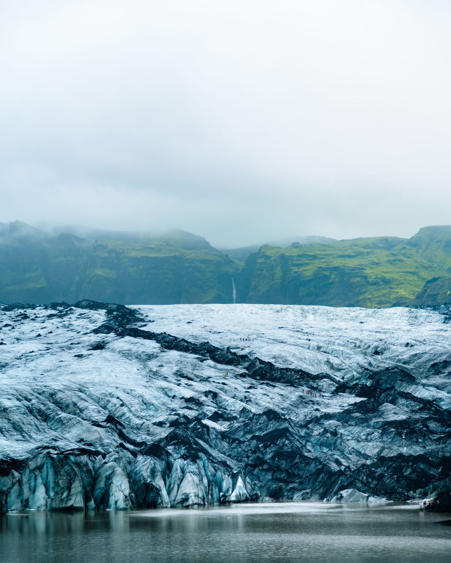
Iceland
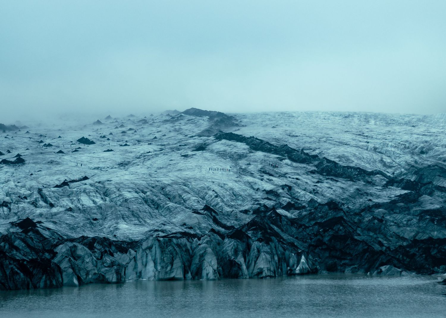
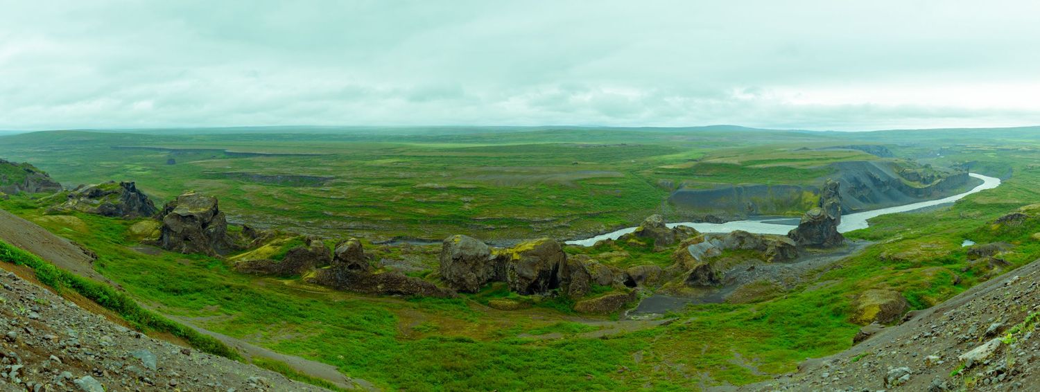
About 200 million years ago, Pangea started to break apart, and during this process, the North American plate started to move west towards where it is now. During this process, 70 million years later, the Atlantic Ocean starts to form. Then once the Atlantic is formed, the Atlantic Ocean starts to have its ridges spreading, which opens up cracks into the Earth's core, which makes it easier for the magma to rise up and release pressure. This is the start of an active magma hotspot right where Iceland is now. This hotspot has been active for the last 60 million years since today. The mountains seen in my shots of Iceland are combinations of volcanic activity under ice, and erosion where some rock solidified stronger than others, allowing for erosion to sweep away some of it while keeping the strong rock. The 4th image is an example of a tuya where a volcano erupted during Iceland's last ice age under hundreds of feet of ice, making the magma cool immediately and shape more like a cone since the heat was concentrated at the top creating a sharp peak like it has.